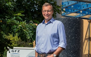
Geodesy is the science of surveying the Earth’s surface. But is there anything left to measure since the times of Magellan and Humboldt? We are talking about this question and about modern geodesy with Harald Schuh, Director of GFZ department Geodesy and Head of section Space Geodetic Techniques.
GFZ: Is geodesy as a science still relevant in modern times?
Harald Schuh: The geodesy is still relevant because a lot of things changed since the times of Humboldt and Magellan. The basic aims are the same but today, in the era of satellites and computers, we have access to completely different technical options and have amazing measuring accuracies available. We are now able to evaluate giant amounts of data, and to operate trillions of calculations per day, continuously and in near real-time. For many applications, for example in earthquake research, the science of geodesy is fundamental.
GFZ: What is the science of geodesy dealing with?
Schuh: A classic task is to mathematically describe data points on the Earth’s surface. Besides this we also investigate the physical properties of the Earth, like the Earth’s gravity field and the motion of the North pole – which corresponds to the intersection of the Earth rotation axis with the surface of the Earth – the pole changes its position every day by several centimeters. The gravity field is of major importance here, because it is not expressed uniformly across the globe. Water for example aligns itself according to it and it has an impact on the trajectory of satellites. To set the trajectories of satellites I need to know the strength of the gravity field at different locations. In modern geodesy we also deal with the surrounding celestial bodies.
GFZ: The Earth is a dynamic planet, the plates are in constant motion with different speed. What do you align your measurements to?
Schuh: The Earth is neither a disc nor a sphere, it is a flattened rotational ellipsoid. We have to ask ourselves the question of how to convert points of the Earth surface on the ellipsoid. I can only give changes of a measuring point if I have a global reference system. For many purposes the ellipsoid is still used. But besides we also use the concept of the so-called Cartesian coordinate system, a three dimensional system that gives the Earth an x, y, and z axis. This is the global reference frame, with the center of the Earth referring to the center of the coordinate system. Like this, I can exactly determine any point of the Earth with its position within this coordinate system.
For changes in sea level I would like to know whether it rose or whether the land sank. Level measurements can only provide relative changes between the sea level and the surface of the land. Further, the earth is rotating around its own axis and the position of the poles is changing. This is why we also need fix celestial reference points. We get it via the Very Long Baseline Interferometry.
GFZ: The Very Long Baseline Interferometry is one of your areas of expertise. What is this exactly?
Schuh: The method of Very Long Baseline Interferometry, VLBI, is used in geodesy for about forty years now. Originally, it was developed in the field of astrophysics in the 1930th, to investigate so-called quasars or radio galaxies that exist infinitely far away from us at the edge of the universe. Usually, they are visually non-detectable, but their radiation can be detected with large radio telescopes.
In the 1960th there was the suggestion to use two of the telescopes together, and to connect them for a better resolution. It was quickly recognized that this method can also be used to precisely determine the distance between those two telescopes. This was their first geodetic application. Today, there exist about 50 radio telescopes that serve as a reference frame.
GFZ: Are there further applications of radio interferometry in the field of geodesy?
Schuh: Even more important for geodesy is the fact that the radio sources, which are quasars or radio galaxies, are that far away from the Earth that they virtually do not change their position at all. Like this, they serve as a fix celestial reference system.
With this system, we also have the possibility to measure magnitudes like the irregular rotation of the Earth around its axis that cannot be measured with satellites. Furthermore, we need to adjust the GPS and other global navigation satellite systems, called GNSS, which is done every three days.
GFZ: This is how you can also determine movements on the Earth’s surface?
Schuh: Right. Today we know that the plates move for about some millimeters up to eight centimeters per year for the larger plates. We can also monitor volcanoes or sea level changes. The global sea level rose by about three to four centimeters per year within the last twenty years. Before that it was only about one centimeter. These apparently small changes are something that we are able to measure today. We do not need to wait a hundred years until the change in sea level is visible.
A challenge in geodesy is measuring heights. Giving elevations based on the ellipsoid does not tell me anything about how different points on the Earth are located to each other. Is there water between them? Are they moving towards each other or away from each other? This is of importance for example for sewage conduit construction or any artificial waterway.
GFZ: Do the near real-time measurements of movements of the Earth’s surface serve as early warning systems, for example for earthquakes?
Schuh: We distinguish between long-term phenomena like climate change or plate tectonics and real time applications. Our contribution to long-term phenomena is their quantification related to a fix reference frame. With volcanism, for example, eruptions normally build up for several days or weeks. The magma is slowly rising and thereby causing deformations of the Earth’s surface. These are long-term observations which are above the time scale of minutes or seconds.
On the other hand there are the real-time applications. Here, we can for example give information on the elevation of a land mass following an earthquake. Were it centimeters or meters? Was the movement horizontal or vertical?
The quake offshore of Japan from March 11 in 2011 that caused the nuclear disaster of Fukushima led to a horizontal movement of the coastal area of 3.70 meters. Within only one minute! The vertical movement was about 70 to 80 centimeters! Back then it was not possible to directly measure it. It was reconstructed afterwards. Only since a few years now we are able in a few regions of the world to have the data of the surface movements available within minutes or even seconds. Like this it is possible to turn down critical systems like nuclear plants or other electrical power stations before a tsunami wave arrives, for example. Or there is time to close dams or warn the public.
GFZ: What are differences between VLBI, GNSS, and GPS?
Schuh: VLBI is the most exact method of measuring, we are close to the millimeter now, on a global scale. Furthermore, since radio telescopes are large constructions and not only small antennas like for the GPS, there are no deviations in long-term measurements when there is for example snowfall or when an antenna needs to be replaced and the new one slightly deviates from the old one by some millimeters.
GPS on the other hand has the advantage of being much cheaper than VLBI, which is why there are far more stations. This is why regional deformations are best measured by GPS. But globally, VLBI and the Satellite Laser Ranging, SLR - we also run a SLR-station at the GFZ - are the more important techniques. The SLR exists since 1964 and still it is the most exact space-based geodetic technique.
GNSS is a superordinate term, the most familiar application is GPS but we also have the Russian Glonass, the European Galileo, and the Chinese Beidou. Via multi-GNSS several GPS-systems are linked, for example. Together, they are not only used for positioning but also for volcano or earthquake monitoring or in shipping or air traffic control.
GFZ: Are there central stations where all the data are collected?
Schuh: Yes, the international cooperation is the secret of success. Within the last twenty years the international services were installed. Here the data are bundled and all operations are planned and organized.
The VLBI for example was dominated by the NASA in the late 1970th, early 1980th. All data were collected there. I was a PhD student during that time and later worked as a postdoc. Back then cooperation was based on acclamation: You were just calling NASA by phone to ask: “Are you interested in a 24 hour measuring session on this and that topic during this and that day?”
There came the time when everybody said “This is not how it can be done. We need to do constant measurements, the data need to be centrally collected, and we need an equally organized international coordination”. This was when the international VLBI service was established in 1999. I was the president of the Directing Board for seven years. Likewise there are the international SLR and GNSS services. The International GNSS Service IGS is clearly the largest one. Here at the GFZ, we also run an analysis centre.
I use to say that most people do not know that GPS orbits need to be calculated. They don’t exist just like that in the sky. We are one out of ten centres worldwide that calculate GPS orbits. Without this there would not be no positioning or navigation via GPS.
GFZ: Does the existence of these services result in any specific economic benefit?
Schuh: There are a lot of relevant economic benefits, for example in fleet management of for shipping companies where the tracks of ships or trucks need to be calculated. The better the tracks are calculated, the less fuel is needed and the less greenhouse gas is emitted, and the larger is the economic benefit.
Or the presision farming: Here, the farmer for example needs to know on which track a harvester should be directed on a field, to save time and to reduce fuel consumption or to optimally spread fertilizer. It’s thirty centimeters here that is important, especially in countries like Australia or the USA with their giant fields.
Another example is the determination of atmospheric parameters via GPS or VLBI. Both techniques observe waves in the radio frequency range that are bend by atmospheric water vapor. Unlike air pressure or temperature, water vapor is hard to measure, but is of special importance for weather forecasting.
For more than ten years now we systematically analyze water vapor in Central Europe. Other countries did not reach this level yet but are very interested to do so. For about five years now we forward these data to the meteorological services where they are used for weather forecasting. Like this, weather forecast was improved by 30 percent, especially for small-scale changes. In Austria with its mountains for example, every valley has its own weather. Here you need a high resolution of tropospheric data.
An improved weather forecasting results in many different economic benefits, again, for example, in the field of agriculture: if a farmer knows about a severe weather coming the next day, she will be harvesting today to avoid economic loss.
Very conservative surveys from the USA calculated an annual economic benefit for the USA from GPS of about 80 billion US Dollar. This, however, can only serve as a rough estimation. With only a little bit of imagination you can easily think of the benefit being twice as high, because it affects so many different fields of application. Globally, you can easily think of an economic benefit of several hundreds of billions that are saved or additionally generated.
GFZ: What about the sciences?
Schuh: Water vapor also acts as a greenhouse gas. By measuring it for ten, twenty or thirty years, you can identify trends in changes of atmospheric water vapor – even on a seasonal scale. Many GPS stations exist for twenty years now, and with 35 years the VLBI stations are even older. This makes the measured trends even more reliable and applicable for climate research. The solid VLBI stations can serve as anchor points for global climate models.
GFZ: Tell me about exciting developments in your field. What can we expect for the future?
Schuh: Of course we would like to measure constantly, since some phenomena happen within only a few hours. To capture local changes in alpine valleys for example, we need a better coverage of GPS stations. We also do need this to analyze regional deformations following an earthquake like the one in Japan. The Japanese GPS system today comprises 1300 stations with a distance of only ten to twenty kilometers to each other on the main island.
GFZ: This coverage is probably something that you would like to have on a global scale.
Schuh: Exactly (laughing). With 400 GPS stations in Germany we are not that bad. But most of the other countries have a much worse spatial resolution. The spatial resolution is something that can be improved in the future.
Another spectacular development that is of great interest for us is in the field of experimental physics. There is a new technologic development in quantum technology. New kind of clocks were invented that are even more precise by a factor of one thousand than “classical” atomic clocks. Soon these clocks will reach a precision of 10 to the power of minus 18.
With these precise clocks we have a technology at hand for the determination of differences in height which is of fundamental importance in geodesy. Therewith we are able to measure the difference in height between a floor and the top side of a table using clocks. You put one clock on the table and one on the floor and you can measure the difference in elevation being exactly 85 centimeters.
GFZ: …because time is depending on gravitation?
Schuh: Exactly. Like described in the theory of relativity time is changed by the impact of gravity. Objects in different heights are exposed to gravity differently. Furthermore, there are new concepts of optical interferometry that were also used for the discovery of gravitational waves and that we also use for the GRACE-Follow-on mission to measure the distance of about 220 kilometers between the two satellites with sub-micrometer accuracy.
Also from quantum technology come the so called atomic gravimeters that can also be used to more precisely measure local gravity. Right now, there are many new and exciting technological opportunities that can be used by us in geodesy.
03.04.2017
The interview was led by Ariane Kujau
-----------
Event notes:
<link zentrum veranstaltungen detail article ausstellung-fokus-erde-von-der-vermessung-unserer-welt>>>“Fokus: Erde. Von der Vermessung unserer Welt“ Die Ausstellung im Haus der Brandenburgisch-Preußischen Geschichte
<link zentrum veranstaltungen detail article vortrag-die-rueckkehr-der-globalen-seismologie-zu-ihrem-ursprungsort>>>Vortrag: Die Rückkehr der globalen Seismologie zu ihrem Ursprungsort
<link zentrum veranstaltungen detail article vortrag-100-jahre-nach-helmert-heutige-geodaetische-forschung-auf-dem-potsdamer-telegrafenberg>>>Vortrag: 100 Jahre nach Helmert . Heutige geodätische Forschung auf dem Potsdamer Telegrafenberg
>>Vortrag: Von Humboldt zu dem Swarm-Satelliten – Erforschung des Erdmagnetfelds in Potsdam



![[Translate to English:] [Translate to English:] Abror Gafurov von dem Schriftzug "Welcome to Azerbaijan" und den UN und COP Logos](/fileadmin/_processed_/2/5/csm_2024_11_Baku_COP29_Abror_Gafurov_1042faec82.jpeg)


![[Translate to English:] Martin Herold standing in front of the library on the Telegrafenberg](/fileadmin/_processed_/c/d/csm_Martin_Herold_d385ee4dd9.jpeg)
![[Translate to English:] Many people are listening to a presentation in the GFZ lecture hall.](/fileadmin/_processed_/c/a/csm_1_Bild1_hell_b9c0e9f5ed.jpeg)



![[Translate to English:] Both scientists sitting on stools in front of a wall of books in the Telegrafenberg library](/fileadmin/_processed_/6/6/csm_Buiter_Castell_DORA_4_e87cb1ea18.jpeg)
![[Translate to English:] Gruppenbild mit 4 Personen](/fileadmin/_processed_/8/d/csm_20241017_GFZ-Emmerman-Medal-005_web_reinhardtundsommer_21a414fa4a.jpeg)

![[Translate to English:] Ice landscape with five red tents](/fileadmin/_processed_/8/9/csm_Zeltlager_auf_dem_Eis_Urheberin_Jenine_McCutcheon_5ced2d523b.jpeg)
