GFZ German research centre for geo sciences

Section 4.6: Geomorphology

Large Projects

AIRWAVES

An automated high resolution water sampler for environmental monitoring

Obtaining rain samples from remote locations is a tough challenge - not only to scientists. Hence we are developing an automated rain sampler that allows to detect minute changes in isotopic composition even after months in the field.

GyroSCoPe

Geomorphic and Sedimentary responses to Climate Periodicity

With this ERC funded project, we explore how different periodicities of climate forcing affect erosion in mountainous regions, how downstream rivers respond through aggradation or incision, and how pulses of sediment are modified before reaching depositional sinks.

Individual Projects

EifelfloodS

Eifel Flood Event 2021 HART action

EifelfloodS aims to secure and analyse airborne LiDAR and optical data and field based evidence of flood dynamics and damage condition, predominantly in headwater regions, before diffusion erases the traces.

eseis

Environmental Seismology

Environmental seismology is a central project cluster of the section. Seismic sensors are used to detect, locate, track and quantify geomorphic processes, from landslides and rockfalls over debris flows and fluvial activity, to the interaction of drivers and processes.

STEEPclim

Reconstructing abrupt climate changes during the Late Glacial from lacustrine sediments

With this ERC funded project we investigate the spatiotemporal evolution of the hydrological cycle during the Late Glacial Period using biomarker isotope signatures to identify regions that are particularly prone to modern climate change.

Past Projects

Fatigue, Rock Damage, and Erosion on Rocky Coasts

The mechanics of sea cliff erosion at the event-scale remain poorly understood. This project aims to quantify the role of small, cyclic stresses via wave action in modifying cliff rock strength and driving cliff erosion through the application of geophysical methods.

ICEHouse

Impacts of Climate change on Erosion rates and Hillslope processes

In this set of projects, we investigate how millennial-scale climate forcing has affected local paleoclimate, and how landscapes respond with respect to erosion rates, erosion processes, and sedimentation patterns.

LandFlux

Landslides are the primary erosional mechanism in mountainous areas. A new methodology for quantifying long-term landslide rates and contributions to sediment fluxes is developed, by using analyses of cosogenic radionuclides in combination with detailed field surveys.

Stone Pavements

Stone pavements are widespread surface features in deserts globally. They are the result of the deposition of dust, not erosion. They can form continuously thickening recorders of the environmental conditions during which they formed.


Hydroclimatic Variability of the Trans-Himalayan Region

Climate change has altered precipitation patterns and impacted the spatio-temporal distribution and availability of water in high-mountain environments. We strive to develop a centennial record of monsoon dynamics from yearly resolved tree ring isotope chronologies.

ROCcycle

The significance of organic carbon in the global carbon cycle

Oceans are important long-term sinks of organic carbon. With ROCcycle we quantify the amounts of fossil and modern biospheric carbon exported through major river systems and investigate effects of tectonic and surface processes as well as extreme rainfall events.

High Resolution Monitoring of a Rapidly Eroding Gorge

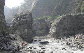
The Da'an River gorge in western Taiwan is the result of uplift of the riverbed during an earthquake in 1999. The river is now rapidly incising which provides an ideal opportunity to study the site by means of high resolution topographic surveying.

Seismic Signal Signature of Cracks Prior to a Mass Wasting Event

Mass wasting events are preceded by the appearance and the propagation of cracks. Identifying them in a robust and consistent way is crucial for hazard anticipation. This project use seismic signal analysis coupled to machine learning technique to retrieve crack temporal and spatial evolution.

PRESSurE

Perturbations of Earth Surface Systems by large Earthquakes

Since the 2015 Gorkha earthquake of Mw7.9 GFZ's Hazard and Risk Team is investigating the impact of earthquakes and inter-seismic erosion in the Himalayan landscape evolution with a complex monitoring network in Nepal.

Chemical Weathering: From Soils To Landslides

The chemical weathering of carbonate and silicate rocks in rapidly eroding mountains exerts a strong control on Earth’s carbon cycle. The aim of this project is to constrain the impact of soil and landslide erosion processes on carbonate and silicate weathering.

back to top of main content