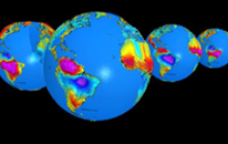
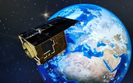
The task of geodesy is to measure in detail the shape and rotation of the Earth, its orientation in space, its surface, and its gravitational field. For that purpose we analyse and interpret data from various national and international satellite missions for remote sensing of the Earth from space like, e.g., the GRACE and GRACE-FO (Gravity Recovery and Climate Experiment, and its Follow-On mission) satellites, and develop new systems like the mission EnMAP (Environmental Mapping and Analysis Program) which started in April 2022 .
We use signals of the American GPS, the Russian GLONASS, and the Chinese Compass/Beidou satellites for geoscience and atmospheric research. We are also contributing to the development of the European satellite navigation system Galileo, which is incorporated into our Research. These four systems are summarized as GNSS, Global Navigation Satellite Systems. Measurements from airplanes and ground-based geodetic observations, as well as the development and application of corresponding analysis techniques, round out the spectrum of our tasks. Finally, we utilize all these measurements and observations in computer models in order to simulate and understand the dynamic processes in the Earth’s interior, on its surface, in the oceans, in the atmosphere and cryosphere.
To better understand something that is very close, it often helps to view it from a distance. This is also true for Earth science research, where the perspective from near-Earth space allows a completely new look on our planet.
For example, the orbits of satellites can give us information about the shape of the Earth and its gravitational field. If the masses in the Earth interior were uniformly distributed, our rotating home planet would have the shape of a flattened sphere or a rotational ellipsoid, respectively. In reality, however, the inside of the Earth is anything but homogeneous: In the Earth’s crust, thick sedimentary layers alternate with huge blocks of granite. The roots of the high mountain ranges reach deep into the upper mantle, while the Earth’s crust under the oceans is relatively thin. Density variations in the Earth's mantle and core also influence its gravitational field and through that, the Earth's shape. From high-precision measurements of a satellite path we can infer spatial and temporal gravity variations that provide information about the structure and dynamic changes in the Earth's interior and on its surface. Large-scale mass changes, induced, e.g., by deglaciation of ice masses in Greenland and Antarctica, can be quantified very accurately by these techniques.
In addition to the precise determination of satellite orbits, we analyse recordings from different sensors on numerous satellites. The precise surveying of ocean and ice surfaces with the technique of satellite altimetry belongs to this. Apart from the data from the GNSS satellites, also the laser distance measurements from satellites (SLR, satellite laser ranging) and the Very Long Baseline Interferometry (VLBI) belong to space geodetic techniques. A combination of these techniques gives information about the shape of the Earth and the movements of tectonic plates. An important task hereby is the realization of a world-wide reference frame, which is necessary to enable, for instance, the precise measurement of the global sea level rise. From these manifold geodetic observations, information on the condition of the atmosphere that we provide for daily weather forecasting can be derived as well. We also analyse measurements of remote sensing satellites in order to understand the effects of climate change or to contribute to natural disaster risk mitigation strategies.
An additional research field is the application-oriented development of remote sensing research based on multi-temporal observation of bio- and geophysical parameters as well as surface deformation using optical and radar remote sensing systems for a broad spectrum of research questions within geo- and environmental sciences. Our research includes the topics of soil and land degradation studies, surface deformation, geological exploration, precision agriculture and global vegetation functioning, natural and man-made hazards, and land-atmosphere interactions. We hold the role of scientific leadership of the German hyperspectral satellite mission EnMAP and are involved in the definition of future hyperspectral satellite missions. To analyse and interprete the large amount of data from observation and simulation we develop approaches for information extraction on the basis of data mining/machine learning, visual data exploration as well as database and Big Data oriented technologies.
The interplay of information from all these collected data gives a dynamic overall picture of a very complex Earth system whose past history and future development is described and predicted in computer models. Our simulations range from the dynamics of the Earth's core and its surface to the investigation of the interactions between atmosphere, the oceans, and the solid Earth. The data, as well as the geoscientific results, are explored, analysed, and visualised with state-of-the-art geoinformation processing techniques and made available to other users.
Anniversary celebrations of F.R. Helmert and the Potsdam Geodetic Institute (GFZ, 6 April 2017) + exhibition Focus: Earth
Download the report here: pdf file (1.1 M)


![[Translate to English:] [Translate to English:] GRACE-FO-Satelliten](/fileadmin/_processed_/0/9/csm_S11_M_f9539dcb9d.jpeg)

![[Translate to English:] [Translate to English:] Banner](/fileadmin/_processed_/9/a/csm_banner_OBP_anom_GR_3_cropped_border_a165ca0d01.jpeg)


