A prominent feature of climate change is an increase in the frequency of extreme weather situations (like droughts or flooding events). Therefore observations of water level and soil moisture are required in order to improve the hydrological models, especially in areas with agricultural background like Morocco to better understand and predict these events.
Satellite-based radar altimetry (e.g., JASON-2) or soil moisture measurements with the SMOS mission (Soil Moisture and Ocean Salinity) provide high accuracy data on a global scale but show a low spatio-temporal resolution. Ground-based measurements leveling and soil moisture measurements also have a high accuracy and a good temporal resolution but are restricted to one location only. GNSS-Reflectometry (GNSS-R) is widely applied within ground-based experiments but can be potentially applied also aboard satellites and combines both, altimetric and soil moisture measurements with the promise of favorable spatio-temporal resolution.
The main goal of the Morocco-German research project PMARS (Programme Maroc-Allemand de Recherche Scientifique) is to widen the bi-national scientific collaboration and to improve the data base for hydrological modelling using the innovative GNSS-R measurements. PMARS is a collaboration between GFZ and the University of Mohammedia for Engineers in Rabat, Morocco (Fig. 1). The project is funded by the German and Moroccan Ministries of Education and Research.
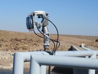
Within this initial campaign, two types of GNSS-R measurements were started. One measuring station was placed directly at the railing of the dam to measure water level changes of the dam. To track the direct and reflected GPS signals separately, three antennas were used (Fig. 3). The first antenna for the direct signals was facing zenith direction, whereas the other two antennas were directed towards the water for the tracking of the reflected GPS signals (L1 and L2).
The second station is focused to GNSS-R-based soil moisture determination. It is planned to get at least a one-year data set to cover a full annual cycle. The GNSS soil moisture data will be validated with other nearby soil moisture sensors. In addition, also soil samples are extracted and analyzed regularly with respect to soil moisture (see Fig 4).
References:
[1] K. M. Larson, J. J. Braun, E. E Small, V. U. Zavorotny, E. D. Gutmann, and A. L. Bilich: : GPS Multipath and Its Relation to Near-Surface Soil Moisture Content, IEEE JSTARS, Vol. 3, No. 1, 2010, Doi: 10.1109/JSTARS.2009.2033612.
[2] J. Beckheinrich, G. Beyerle, S. Schön, H. Apel, M. Semmling, J. Wickert: WISDOM: GNSS-R based flood monitoring, in Proc. IEEE Workshop on Reflectometry Using GNSS and Other Signals of Opportunity (GNSS+R), 10–11, 2012. Doi: 10.1109/GNSSR.2012.6408257


