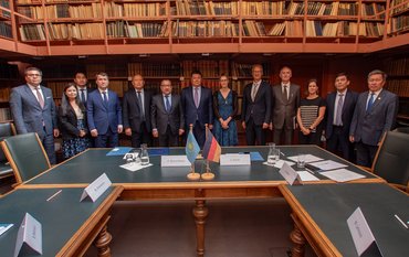
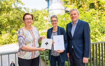
On March 9, 2020 in Berlin, Federal Minister of Agriculture Julia Klöckner presented the funding decision to the AgriSens DEMMIN 4.0 project, which aims to test and promote digital technologies and the use of remote sensing data in agriculture. Representatives of the participating research institutes at the Federal Ministry of Food and Agriculture (BMEL) received the funding decision. The project will be funded with 3.7 million euros. A total of 50 million euros have been earmarked in Germany up to 2023 to promote so-called experimental fields in agriculture.
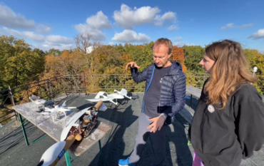
Geodata, in particular data from remote sensing sensors on satellites, aircraft and drones, may in the future enable agricultural enterprises to increase their productivity and at the same time protect the environment and biodiversity. AgriSens DEMMIN 4.0 (remote sensing technologies for digitisation in crop production) is a regional, digital experimental field in Mecklenburg-Western Pomerania for testing corresponding technologies.
The research association AgriSens DEMMIN 4.0, is coordinated by the German Research Centre for Geosciences (GFZ) Potsdam. Further project partners are the German Aerospace Center (DLR) in Neustrelitz, Oberpfaffenhofen and Jena, the Research Center for Agricultural Remote Sensing of the Julius Kühn Institute (FLF-JKI) in Braunschweig, the German Weather Service (DWD), the Martin Luther University Halle-Wittenberg (MLU), the Friedrich Schiller University Jena (FSU), the Julius Maximilian University Würzburg (JMU), and the University of Applied Sciences Neubrandenburg (HS-NB). Agricultural enterprises from the Demmin area in Mecklenburg-Western Pomerania, as well as partner enterprises of the participating institutions, which are spread all over Germany, are involved with practical studies. Other interested agricultural enterprises can still join the project.
Daniel Spengler, project coordinator, spokesperson of the experimental field and scientific assistant at GFZ Potsdam: "Remote sensing data provide rich data treasures that can give farmers important information for the management of their land as a basis for decisions on measures such as fertilisation, sowing or soil cultivation. At present, the hurdle to use these data is unfortunately far too high for many farmers. This applies above all to access to the data, its use in an abundance of software solutions and confusing market offers. With the AgriSens DEMMIN experimental field, we want to offer low-threshold solutions for farmers and provide an introduction to the use of remote sensing and other geodata such as weather data and field observations".
Further information:
Scientific contact:
Dr. Daniel Spengler
Section Remote Sensing and Geoinformatics
Helmholtz Centre Potsdam
GFZ German Research Centre for Geosciences
Phone: +49 331 288-1764
Email: Daniel.Spengler@gfz-potsdam.de
Media contact:
Dipl.-Phys. Philipp Hummel
Public and Media Relations
Helmholtz Centre Potsdam
GFZ German Research Centre for Geosciences
Telegrafenberg
14473 Potsdam
Phone: +49 331 288-1049
Email: Philipp.Hummel@gfz-potsdam.de
Twitter: @GFZ_Potsdam


![[Translate to English:] [Translate to English:] Abror Gafurov von dem Schriftzug "Welcome to Azerbaijan" und den UN und COP Logos](/fileadmin/_processed_/2/5/csm_2024_11_Baku_COP29_Abror_Gafurov_1042faec82.jpeg)


![[Translate to English:] Martin Herold standing in front of the library on the Telegrafenberg](/fileadmin/_processed_/c/d/csm_Martin_Herold_d385ee4dd9.jpeg)
![[Translate to English:] Many people are listening to a presentation in the GFZ lecture hall.](/fileadmin/_processed_/c/a/csm_1_Bild1_hell_b9c0e9f5ed.jpeg)




![[Translate to English:] Both scientists sitting on stools in front of a wall of books in the Telegrafenberg library](/fileadmin/_processed_/6/6/csm_Buiter_Castell_DORA_4_e87cb1ea18.jpeg)
![[Translate to English:] Gruppenbild mit 4 Personen](/fileadmin/_processed_/8/d/csm_20241017_GFZ-Emmerman-Medal-005_web_reinhardtundsommer_21a414fa4a.jpeg)
![[Translate to English:] Ice landscape with five red tents](/fileadmin/_processed_/8/9/csm_Zeltlager_auf_dem_Eis_Urheberin_Jenine_McCutcheon_5ced2d523b.jpeg)
