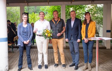
"Getting 51 institutions from 13 countries to collaborate is worth a celebration by itself," said Susanne Buiter, GFZ Scientific Executive Director, at the beginning of her speech at the two-day kick-off meeting of the Geo-INQUIRE project. The 14.2 million euro project officially started on 1 October and is coordinated by the two GFZ scientists Fabrice Cotton and Angelo Strollo.
Geo-INQUIRE stands for Geosphere INfrastructures for QUestions into Integrated Research. The project aims to bring together an enormous set of geodata and make it interoperable, open and FAIR, among other things to gain new insights into the dynamics of the Earth and to better manage precious georesources. At the same time, meaningfully linked data enables us to better manage natural hazards as well as anthropogenic geohazards. In the past, the focus was often on single hazards, i.e. tsunami hazards, flood risks or volcanism were considered in isolation. Through the enhanced data access developed in the Geo-INQUIRE project, hazards that can exist simultaneously at one location - such as earthquakes and landslides - are to become assessable together. Because, Susanne Buiter continues: " We do not need only observations, but we need these observations to talk to each other, to be integrated. Only in that way we can really make steps forward. The focus of bringing data together in an interoperable way is very promising." The goal is to bring together the immense mix of data from different instruments and numerous stations - there are more than 15,000 seismological stations alone - and make it available to researchers around the world including also software as a service and computational facilities. New types of high-tech data, which can be acquired with fibre-optic cables, for example, also play a major role in this.
But low-tech data is also becoming increasingly interesting for science. More and more of it is being collected with smartphones. For example, during a recent earthquake on the German-French border alone, more than 1600 felt reports were collected. The challenge, says Fabrice Cotton, is to find ways to also use such observational data, which can potentially be very useful. "One of our main motivations in all this is that we believe that the integration of numerous parameters and instruments will lead to new insights and discoveries," says Fabrice Cotton. Curiosity-driven research with the spatially as well as temporally high-resolution data is therefore one important component of the project.
Another is the management of the data. We are now confronted with immensely large amounts of data in research and Earth observation. We now need to find ways to intelligently manage these hundreds of terabytes of data and how to connect them to new physics-based models. This also requires good links to high-performance computing, as well as innovative data management and visualisation techniques at the interface with high-performance computing facilities. Ultimately, all these data are resources that are of great importance for the analysis of the dynamics of the solid Earth on the one hand and the interplay of the ocean and atmosphere on the other.
Many special trainings will also take place during the project period - already planned are e.g. "Big Datathons" in Krakow and Bologna. And last but not least, the project will also undertake self-proclaimed major efforts in other respects: The project participants have explicitly resolved to act in a family-friendly way and to pay attention to equality, diversity and inclusivity. All this with the intention of being able to come up with excellent results in four years.
More information: https://www.gfz-potsdam.de/en/press/news/details/foerderung-der-grundlagenforschung-zur-festen-erde


![[Translate to English:] Eine Frau mit weißem Kopftuch und ein Mann mit dunklen Haaren sitzen vor mehreren großen Computerbildschirmen mit Messdaten und Karten.](/fileadmin/_processed_/7/f/csm_20241221_PM-GITEWS_Abb0_Kachel_2b4cf3de2f.jpeg)



![[Translate to English:] [Translate to English:] Abror Gafurov von dem Schriftzug "Welcome to Azerbaijan" und den UN und COP Logos](/fileadmin/_processed_/2/5/csm_2024_11_Baku_COP29_Abror_Gafurov_1042faec82.jpeg)


![[Translate to English:] Martin Herold standing in front of the library on the Telegrafenberg](/fileadmin/_processed_/c/d/csm_Martin_Herold_d385ee4dd9.jpeg)
![[Translate to English:] Many people are listening to a presentation in the GFZ lecture hall.](/fileadmin/_processed_/c/a/csm_1_Bild1_hell_b9c0e9f5ed.jpeg)



![[Translate to English:] Both scientists sitting on stools in front of a wall of books in the Telegrafenberg library](/fileadmin/_processed_/6/6/csm_Buiter_Castell_DORA_4_e87cb1ea18.jpeg)
![[Translate to English:] Gruppenbild mit 4 Personen](/fileadmin/_processed_/8/d/csm_20241017_GFZ-Emmerman-Medal-005_web_reinhardtundsommer_21a414fa4a.jpeg)
![[Translate to English:] Ice landscape with five red tents](/fileadmin/_processed_/8/9/csm_Zeltlager_auf_dem_Eis_Urheberin_Jenine_McCutcheon_5ced2d523b.jpeg)
