Summary
Satellite data offer valuable information to better understand the Earth's surface and its processes, and they are increasingly available free of charge. This makes them interesting not only for science, but also for users from such diverse fields as agriculture & forestry, nature conservation, planning and public authorities. To make it easier for them to access and use remote sensing data, the German Research Centre for Geosciences Potsdam is now offering a series of digital training courses on remote sensing via its recently opened web platform FERN.Lern. As of today, the online course 'Beyond the Visible - Introduction to Hyperspectral Remote Sensing' is available for individual learning as part of the HYPERedu initiative, for which more than 500 people have already registered. It teaches the basics of imaging spectroscopy. Other offers are already running successfully. Like the SAPIENS online training courses, for which you can already register for a second series in February 2022.
Satellite data as a basis for detailed environmental measurements
Satellite data provide much more than just beautiful pictures of our Earth. Thanks to the increasingly free data policy of the space agencies, up-to-date and spatial environmental information, for example from the Copernicus satellite programme of the European Space Agency (ESA), is available free of charge. It includes high-resolution optical and spectral data, on the basis of which detailed maps and images can be created. This makes it possible, for example, to determine substance inputs in water bodies, determine nutrient and water requirements in agriculture, detect flooded areas or monitor critical infrastructures.
And next year, EnMAP (Environmental Mapping Analysis Program), the first German hyperspectral satellite mission, will be launched. The hyperspectral instrument on board the satellite will register the solar radiation reflected by the Earth from visible light to short-wave infrared. This will provide even more detailed information about the ecosystems on the Earth's land surface.
Potential for agriculture, nature conservation, planning, authorities
The treasure trove of freely available remote sensing data is growing exponentially and is becoming increasingly interesting not only for science, but also for potential users in agriculture and forestry, nature conservation, planning and public authorities. However, the use of these data is still poorly integrated into the everyday work and decision-making processes of many user groups. For many inexperienced users, the inhibition threshold to use satellite data is high. Neither access to the data nor its use is self-explanatory. Tutorials or instructions are usually on a scientific level and often only available in English.
New platform FERN.Lern for digital continuing education
FERN.Lern has set itself the goal of closing this gap between users and researchers. On the recently opened online platform, the German Research Centre for Geosciences now offers external target groups access to newly developed digital education courses. In close exchange with users, training needs are identified and basic knowledge is made available in different digital training formats.
These include:
HYPERedu - A new online learning initiative for hyperspectral remote sensing, funded by the DLR Space Agency with funds from the BMWi
The HYPERedu education initiative is part of the exploitation preparation of the EnMAP mission and aims to train future user groups in the application of hyperspectral data. It provides a steadily growing number of teaching materials and online courses, including as of today
the new Massive Open Online Course (MOOC)
‘Beyond the Visible - Introduction to Hyperspectral Remote Sensing'
The MOOC teaches the basics of imaging spectroscopy, and also gives an overview of freely available data sources and open source software, as well as an introduction to the practical use of data with the EnMAP-Box. It is aimed at students and users around the world and assumes a basic knowledge of optical remote sensing. The course consists of three thematic lessons in English language and is designed to be completed in about five hours at a self-selected time and pace.
Registration via: https://eo-college.org/forums/forum/beyond-the-visible/
SAPIENS- Satellite data for planning, industry, energy management and nature conservation, funded by the Helmholtz Association
In interactive live-online training sessions, participants learn the basics and application fields of multispectral satellite remote sensing. Within the training sessions, practical exercises promote independent work with multispectral satellite data.
The first training series in November 2021 is fully booked (> 200 registrations), and further training courses will be offered in spring next year.
Registration is possible here: https://fernlern.gfz-potsdam.de/live
KONSAB - Communication initiative for the use of satellite data in agriculture and forestry in Brandenburg, funded by MWFK Brandenburg
In a variety of learning videos and web seminars, the basics of satellite remote sensing for agriculture and forestry are taught and application examples are shown.
Increasing interest in digital continuing education
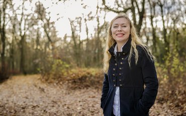
"Our education offers are very well received: We are recording many views of our KONSAB tutorials & videos, the first series of SAPIENS live online training courses were fully booked", says remote sensing expert Nora Meyer zu Erpen, project manager of SAPIENS and FERN.Lern. "From our point of view, this great demand shows an increasing interest in innovative methods and at the same time practical know-how, which has to be prepared in a target group-specific way. For this, we have built up strong didactic, technical and graphic expertise."
You can find all of the GFZ's further education courses on remote sensing via the FERN.Lern web platform. You can also register there.
Contact:
Nora Meyer zu Erpen
Public and Media Relations
Project head SAPIENS and FERN.Lern
Helmholtz Centre Potsdam
GFZ German Research Centre for Geosciences
Telegrafenberg
14473 Potsdam
Phone: +49 331 288-28887
Email: nora.meyer.zu.erpen@gfz-potsdam.de
Dr. Saskia Förster
Section 1.4 Remote Sensing and Geoinformatics
Project head HYPERedu
Helmholtz Centre Potsdam
GFZ German Research Centre for Geosciences
Telegrafenberg
14473 Potsdam
Phone: +49 331 288-28615
Email: saskia.foerster@gfz-potsdam.de





![[Translate to English:] [Translate to English:] Abror Gafurov von dem Schriftzug "Welcome to Azerbaijan" und den UN und COP Logos](/fileadmin/_processed_/2/5/csm_2024_11_Baku_COP29_Abror_Gafurov_1042faec82.jpeg)


![[Translate to English:] Martin Herold standing in front of the library on the Telegrafenberg](/fileadmin/_processed_/c/d/csm_Martin_Herold_d385ee4dd9.jpeg)
![[Translate to English:] Many people are listening to a presentation in the GFZ lecture hall.](/fileadmin/_processed_/c/a/csm_1_Bild1_hell_b9c0e9f5ed.jpeg)



![[Translate to English:] Both scientists sitting on stools in front of a wall of books in the Telegrafenberg library](/fileadmin/_processed_/6/6/csm_Buiter_Castell_DORA_4_e87cb1ea18.jpeg)
![[Translate to English:] Gruppenbild mit 4 Personen](/fileadmin/_processed_/8/d/csm_20241017_GFZ-Emmerman-Medal-005_web_reinhardtundsommer_21a414fa4a.jpeg)
![[Translate to English:] Ice landscape with five red tents](/fileadmin/_processed_/8/9/csm_Zeltlager_auf_dem_Eis_Urheberin_Jenine_McCutcheon_5ced2d523b.jpeg)
