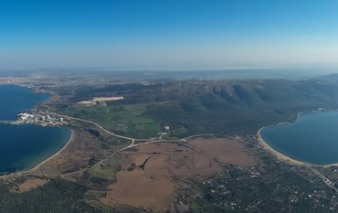
On Friday afternoon around 3 pm local time (1 pm CET) a very strong earthquake under the Mediterranean Sea shook the Turkish coast and Greek islands. Pictures from social media show massive damage to buildings in Turkish cities. There was also a moderate tsunami that hit coastal towns. Pictures from social media show a wave height between one and two meters.
Prof. Marco Bohnhoff, seismologist from the German Research Centre for Geosciences GFZ in Potsdam and an expert on the region, reports:
"This is a so-called normal-faulting quake in the upper Earth's crust. This means that part of the subsoil has moved downwards. The initial depth of the rupture is probably between 15 and 5 kilometers. A fractured area of up to 100 km² has formed there. The quake is due to a continuous stretching of the Earth's crust in a north-south direction. The fracture relieved the strain and reduced the accumulated energy. The slipping of the crust triggered the moderate tsunami observed both on the Greek island of Samos and on the Turkish mainland".
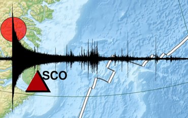
The quake could also be measured at the GEOFON station in Rüdersdorf near Berlin (see seismogram):
https://media.gfz-potsdam.de/gfz/wv/pm/20/11374_gfz2020vimx.png


![[Translate to English:] [Translate to English:] Abror Gafurov von dem Schriftzug "Welcome to Azerbaijan" und den UN und COP Logos](/fileadmin/_processed_/2/5/csm_2024_11_Baku_COP29_Abror_Gafurov_1042faec82.jpeg)


![[Translate to English:] Martin Herold standing in front of the library on the Telegrafenberg](/fileadmin/_processed_/c/d/csm_Martin_Herold_d385ee4dd9.jpeg)
![[Translate to English:] Many people are listening to a presentation in the GFZ lecture hall.](/fileadmin/_processed_/c/a/csm_1_Bild1_hell_b9c0e9f5ed.jpeg)


![[Translate to English:] Both scientists sitting on stools in front of a wall of books in the Telegrafenberg library](/fileadmin/_processed_/6/6/csm_Buiter_Castell_DORA_4_e87cb1ea18.jpeg)
![[Translate to English:] Gruppenbild mit 4 Personen](/fileadmin/_processed_/8/d/csm_20241017_GFZ-Emmerman-Medal-005_web_reinhardtundsommer_21a414fa4a.jpeg)


![[Translate to English:] Ice landscape with five red tents](/fileadmin/_processed_/8/9/csm_Zeltlager_auf_dem_Eis_Urheberin_Jenine_McCutcheon_5ced2d523b.jpeg)
