The research of the Remote Sensing and Geoinformatics Section at the GFZ aims to establish remote sensing as a core method of the geosciences and to exploit remote sensing data for the area-wide mapping of the state of the Earth's surface and the observation of landscape and vegetation development, the impacts of climate change, natural disasters and human use. The Section's research and method development encompasses the entire range of remote sensing, from the scientific development of satellite missions, the large-scale analysis of remote sensing time series to knowledge and technology transfer.
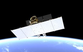
The Section has the scientific lead of the German hyperspectral satellite mission EnMAP, which was successfully launched into space in 2022, and builds on many years of expertise in hyperspectral remote sensing from sensor to application development. The section is also contributing this expertise to the development of ESA's hyperspectral satellite mission CHIME , which will provide the basis for global scientific analyses and the development of operational products and services through its regular coverage of the entire Earth's surfaces. To ensure that the large quantities of remote sensing data available today can also be used in the best possible way by users outside the scientific community, we are transferring our scientific work into practical use. For this purpose, we have founded the transfer lab FERN.Lab .
Our section is characterised by a broad range of expertise in the use of different sensors, platforms and methods in remote sensing. This enables us to detect state and changes on the Earth's surface, to analyse underlying processes and to continuously observe them by long-term monitoring. To do this, we develop methods and sensors for mapping bio- and geophysical surface parameters in the fields of geology, soil, vegetation and atmosphere using remote sensing data from different platforms (satellites, planes, drones), as well as methods for simulating, calibrating and fusing data from different sensors (optical and radar). We investigate the relationship between bio- and geophysical processes and their spectral and three-dimensional representation in remote sensing data by combining spectral and laser measurements in the laboratory, in the field and from flying platforms with the physical, structural and chemical properties of the objects collected by field surveys. We also develop image analysis methods and software that extract changes from time series of remote sensing data and enable users to identify bio- and geophysical processes. For this purpose, we use and adapt Big Data Analytics/Data Science approaches for regional to global observation of critical Earth surface processes.


![[Translate to English:] Fire in a forest, smoke rising, aerial view from above](/fileadmin/_processed_/8/3/csm_2025_01_06_AdobeStock_415831729_6113de1a97.jpeg)

![[Translate to English:] Martin Herold standing in front of the library on the Telegrafenberg](/fileadmin/_processed_/c/d/csm_Martin_Herold_d9a908ced3.jpeg)

![[Translate to English:] [Translate to English:] Puzzelteile](/fileadmin/_processed_/3/1/csm_Kachel_Neue_Mitarbeiterin_Bildnachweis_Nuthawut_%E2%80%93_Adobe_Stock_b64e454eb7.jpeg)
![[Translate to English:] [Translate to English:] Drohne](/fileadmin/_processed_/b/a/csm_20240515_155801_50c6214128.jpeg)
![[Translate to English:] ein riesiges Erdloch in einer kargen Landschaft im Iran mit Bergen im Hintergrund](/fileadmin/_processed_/f/1/csm_DSC_7917_kleiner_3535826df2.jpeg)


