Helmholtz-Zentrum Deutsches Geoforschungszentrum

Sektion 4.6: Geomorphologie

Forschungsschwerpunkte

AIRWAVES

Ein automatisierter, hochauflösender Regensammler für die Umweltüberwachung

Das Sammeln von Regenproben in abgelegenen Regionen stellt nicht nur Wissenschaftler vor unlösbare Probleme. Daher entwickeln wir einen automatisierten Probensammler, der selbst über Monate im Feld winzige Unterschiede in der Isotopenzusammensetzung konserviert.

GyroSCoPe

Geomorphic and Sedimentary responses to Climate Periodicity

With this ERC funded project, we explore how different periodicities of climate forcing affect erosion in mountainous regions, how downstream rivers respond through aggradation or incision, and how pulses of sediment are modified before reaching depositional sinks.

Weitere Projekte

eseis

Umweltseismologie

Seismische Sensoren können geomorphologische Prozesse detektieren, lokalisieren, verfolgen und quantifizieren; von Rutschungen und Steinschlägen über Murgänge und fluviale Dynamik bis hin zur Interaktion von Auslösemechanismen und den tatsächlichen Prozessen.

STEEPclim

Rekonstruktion abrupter Klimawechsel im Jüngeren Dryas aus limnischen Sedimenten 

Um durch den Klimawandel besonders gefährdete Regionen identifizieren zu können, untersuchen wir in diesem ERC-geförderten Projekt unter Zuhilfenahme von Isotopensignaturen abrupte Klimaveränderungen zum Ende der letzten Eiszeit.

Abgeschlossene Projekte

Fatigue, Rock Damage, and Erosion on Rocky Coasts

The mechanics of sea cliff erosion at the event-scale remain poorly understood. This project aims to quantify the role of small, cyclic stresses via wave action in modifying cliff rock strength and driving cliff erosion through the application of geophysical methods.

ICEHouse

Impacts of Climate change on Erosion rates and Hillslope processes

In diesen Projekten untersuchen wir, wie Klimaschwankungen über Zeitskalen von tausenden von Jahren das lokale Paläoklima beeinflussen und wie sich Erosionsraten, Erosions- und Ablagerungsprozesse entsprechend verändern.

LandFlux

Hangrutsche sind der wichtigste Erosionsmechanismus in Bergregionen. Eine neue Methode soll die  Quantifizierung von Rutschungen und ihren Beitrag zum Sedimenttransport unter Verwendung kosmogener Radionuklide und detaillierter Feldstudien erlauben. 

Stone Pavements

Stone pavements are widespread surface features in deserts globally. They are the result of the deposition of dust, not erosion. They can form continuously thickening recorders of the environmental conditions during which they formed.


Hydroclimatic Variability of the Trans-Himalayan Region

Climate change has altered precipitation patterns and impacted the spatio-temporal distribution and availability of water in high-mountain environments. We strive to develop a centennial record of monsoon dynamics from yearly resolved tree ring isotope chronologies.

ROCcycle

Die Rolle von organischem Kohlenstoff im globalen Kohlenstoffkreislauf

Im Himalaya, den Anden und den neuseeländischen Alpen untersuchen wir den Transport organischen Kohlenstoffs in die Ozeane und widmen uns der Frage, welche Rolle Erdoberflächenprozesse, Starkniederschlagsereignisse und die Tektonik dabei spielen.

High Resolution Monitoring of a Rapidly Eroding Gorge

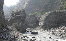
The Da'an River gorge in western Taiwan is the result of uplift of the riverbed during an earthquake in 1999. The river is now rapidly incising which provides an ideal opportunity to study the site by means of high resolution topographic surveying.

Seismic Signal Signature of Cracks Prior to a Mass Wasting Event

Mass wasting events are preceded by the appearance and the propagation of cracks. Identifying them in a robust and consistent way is crucial for hazard anticipation. This project use seismic signal analysis coupled to machine learning technique to retrieve crack temporal and spatial evolution.

PRESSurE

Störung von Oberflächenprozessen durch ein schweres Erdbeben 

2015 erschütterte das Gorkha Erdbeben mit einer Stärke von 7.9 Nepal. Das Hazard and Risk Team vom GFZ untersucht seitdem mit seinem Beobachtungsnetzwerk die Frage, welche Rolle Erdbeben für die Landschaftsentwicklung im Himalaya spielen.

Chemical Weathering: From Soils To Landslides

The chemical weathering of carbonate and silicate rocks in rapidly eroding mountains exerts a strong control on Earth’s carbon cycle. The aim of this project is to constrain the impact of soil and landslide erosion processes on carbonate and silicate weathering.

EifelfloodS

Eifel Flood Event 2021 HART action

EifelfloodS aims to secure and analyse airborne LiDAR and optical data and field based evidence of flood dynamics and damage condition, predominantly in headwater regions, before diffusion erases the traces.

zurück nach oben zum Hauptinhalt